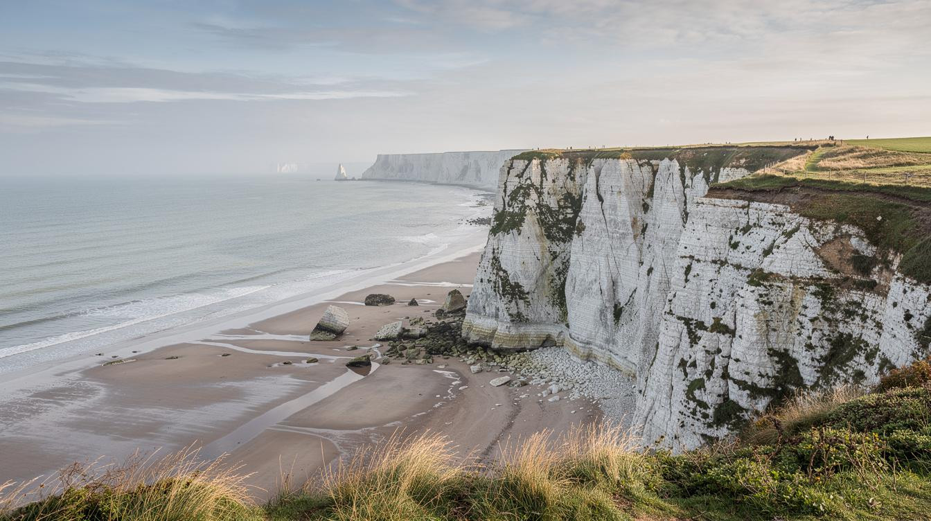
There’s a piece of paper, or more likely a phone screen, that decides how your afternoon ends at Cap Blanc-Nez. It’s the tide table. Get it right and you walk back along a pale chalk beach with England visible across 21 miles of gray-green water. Get it wrong and the sea closes the return route entirely, and you’re standing at the base of a 440-foot cliff with nowhere to go.
That’s not a figure of speech. The chalk face drops almost vertically to the shore, and at high water the Channel comes all the way in. Because there’s no alternative path down, the beach return only works inside a window of roughly two hours around low tide.
Pack a layer too. Wind at the headland runs steady at 20 to 25 mph on most days, and the forecast never quite captures what the exposed cliff adds to that number.
The cliff that faces England and a beach that depends on timing
Cap Blanc-Nez sits on the Opal Coast in Pas-de-Calais, on the D940 near the commune of Sangatte, about 8 miles southwest of Calais. The chalk headland rises to 440 feet, which puts it roughly level with the top of a 40-story building above the Channel. On a clear morning, before the afternoon haze builds along the horizon, the white cliffs of Dover are visible from the French side. It’s simple geometry: the Channel narrows to 21 miles at this crossing, and that’s close enough to see.
Because the cliffs face directly across the narrowest point, the view is legitimately geographic, not just scenic. The same tidal logic that controls a Madagascar sandbar controls this beach: the sea decides what’s accessible, and the schedule is non-negotiable.
And the chalk erodes. Signs at the cliff edge say so plainly, and they mean it. Stay on the marked path.
What the walk actually involves
The cliff path from Escalles to Wissant covers roughly 3.5 miles along the top of the headland. The surface is grass over chalk, uneven in places, with nothing to break the wind coming off the water. The Dover Patrol memorial, a stone structure near the highest point, serves as a useful windbreak if you need one.
But it’s the beach return that gives the walk its shape. At low tide, the shore beneath the cliffs is broad and pale, scattered with chalk blocks that fell from the face during winter storms. Visitors who know to look find marcasite nodules and ammonite fossils worked out of the cliff by seasonal weather. The walk back toward Escalles from below takes about 45 minutes at a slow pace.
A boat captain who has worked this stretch of Channel for decades will tell you the water here looks calm from above and isn’t. The rip patterns near the base of the cliff are unpredictable. The beach is for walking, not swimming.
How to plan around tides and wind
Late May and June give you the best version of this walk. Daylight runs long, temperatures reach 17 to 22°C, and the crowds that fill the car park in July and August haven’t arrived yet. The same shoulder-season logic that clears Naxos beaches in May applies here: it’s touristy in August and nearly yours in June.
Check tide tables through SHOM, the French national tidal service, before you leave Calais. A mid-morning low tide means you can walk the cliff in early light and return on the beach before the sea comes back. Because the window is only about two hours, that timing matters more than the weather forecast does.
And visibility for the England view is almost always better in the morning. Afternoon sea haze along the horizon is reliable enough to plan around.
What Cap Blanc-Nez is not
There are no restaurants at the headland. Bring food. The nearest reliable services are in Calais, 8 miles northeast, or in Wissant village, which has a small number of cafés and a beach-facing terrace that works for lunch if you time the loop correctly. Some of Europe’s most rewarding coastal sites require effort to reach, and this one requires a tide table rather than a boat.
Local guides who run the route regularly say the viewpoint loop from the main car park is worthwhile even without the full beach circuit. For travelers who want the cliff view without the tide-dependent return, the accessible path to the lookout above the Dover Patrol memorial works at any hour.
But the half-day loop is the real thing. Remote, but not hard to reach. Like some white coastal places, it rewards timing over ambition.
Your questions about Cap Blanc-Nez answered
How do I get to Cap Blanc-Nez from Calais?
Cap Blanc-Nez is 8 miles southwest of Calais city center via the D940 coastal road. By car, the drive takes about 15 minutes. There’s no regular bus service to the cliff car park itself. The car park off the D940 is free and large enough to handle most summer weekend traffic, though it fills by mid-morning in July and August.
When is the best time to visit Cap Blanc-Nez?
Late May through June is the strongest window. Daylight is long, temperatures are manageable, and the headland is quieter than it will be in July and August. Because the site is exposed to Channel wind year-round, shoulder-season visits mean better conditions without the car park crowds that compress the experience in peak summer.
Is there an entry fee?
Cap Blanc-Nez is a Grand Site de France and access is free. The car park has no charge. There are no ticketed entry points on the cliff path or beach. The only cost you need to plan around is the drive from Calais, roughly $10-15 in fuel depending on your car.
By the time the sea comes back in, the chalk blocks you walked past twenty minutes ago are already underwater. The Dover cliffs, visible all morning, have gone gray in the afternoon haze. The wind is the same. The cliff is the same. The tide just closed the door.