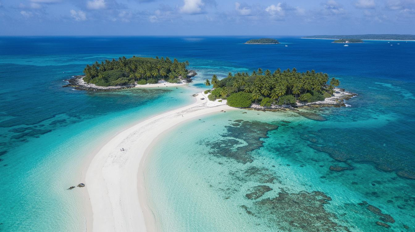
At low tide, a white sand spine rises from the Indian Ocean between two small islands off northwestern Madagascar. At high tide, it disappears. That single tidal fact organizes everything about a day at Nosy Iranja: when the boats leave Nosy Be, when you walk the causeway, and when the window closes. The beach doesn’t wait for you to figure out the schedule.
The two islets are Nosy Iranja Be, the larger inhabited one, and Nosy Iranja Kely, the smaller uninhabited southern islet. Travel sources describe the sandbar connecting them as roughly a mile long. And the water on both sides stays shallow and calm because the surrounding reef filters the chop before it reaches the shore.
How the tidal sandbar works
Because the sandbar only surfaces at low tide, most excursion boats from Nosy Be time their arrival around that window, typically mid-morning. Travelers who arrive on slower vessels or later transfers may find ankle-deep to knee-deep water where the walkway was an hour before. Tidal tables run this schedule, not tour operators.
The water color over the sandbar is the thing that stops people mid-step. Deep blue at the horizon, aquamarine in the mid-distance, pale green over the sand, almost white at the shoreline edge. In May and June, the dry-season light hits flat and hard by 9am, which is exactly the light that makes the sandbar photographs look the way they do.
But the sensory detail that doesn’t make it into photographs is the sand itself. Fine and flour-like when dry, firm and cool when wet from the receding tide. There’s almost no shade on the sandbar. The palms stay on the main island, and the equatorial sun starts to bite early.
What’s on the islands beyond the sandbar
Nosy Iranja Kely hosts nesting sites for green sea turtles and hawksbill turtles, and local guides refer to the smaller islet informally as Turtle Island. Nesting activity peaks between November and March, so May visitors are outside that window. And yet the turtles are present in the surrounding reef waters year-round, and some excursions include a snorkel stop where sightings are common.
Nosy Iranja Be has a small resident fishing community. There are no souvenir shops or restaurants open for walk-in visitors. What’s there, if you go with a guide who knows the island, is the working reality of a place where fishing is the economy and the excursion boats are a minor chapter in the day. That contrast is worth noticing.
Because access is excursion-only, the crowd level is directly tied to how many boats make the crossing on a given morning. The same dynamic shapes Saona Island in the Dominican Republic, where the excursion format itself controls who shows up and when. May and June tend to be quieter than July and August, when European summer travel pushes volume up on Nosy Be.
The honest trade-offs
The boat crossing from Nosy Be takes roughly 1.5 to 2 hours each way. The island sits approximately 16 miles southwest of Nosy Be by water. In choppy conditions, that crossing is genuinely uncomfortable. But May and June fall inside the dry season, so sea conditions are generally manageable.
There’s no café on the sandbar, no toilet on the islet, and no backup plan if conditions shift during your crossing. Similar access friction shapes a Seychelles beach where the logistics are part of what keeps it worth the effort. Travelers who want more control should book a private charter rather than a shared group excursion and confirm the tidal window with the operator in advance.
The smell when you step off the boat in the morning is salt and low-tide seaweed, with something warmer underneath from the sand heating in the sun. It’s an honest smell. Boat-access beaches tend to smell like effort rewarded, and this one is no different.
Your questions about Nosy Iranja answered
How do you actually get to Nosy Iranja from the US?
Fly into Antananarivo (TNR) with a connection, then take a domestic Tsaradia flight to Nosy Be’s Fascene Airport (NOS). From Nosy Be, arrange a boat excursion through your hotel or a local operator. No scheduled public ferry runs to Nosy Iranja. Every transfer is an organized excursion or private charter. Multi-leg access through a small regional airport is the standard format for this kind of Indian Ocean trip.
When is the best time to visit?
May through September is dry season in northwestern Madagascar. Sea conditions are most reliable, visibility is good, and rain is infrequent. May and early June offer the added benefit of lower excursion volume before peak European summer travel season hits Nosy Be in July and August. Cyclone season runs roughly November through March and makes sea crossings unpredictable.
How much does a trip to Nosy Iranja cost?
Organized day trips from Nosy Be run approximately $113 to $150 per person through major booking platforms, with some operators listing packages at $80 to $90 when booked locally and including lunch. Private charter boats cost more, typically $200 to $350 for the vessel. A mid-range traveler should budget $120 to $180 per day total in the Nosy Be area, including accommodation and meals.
One last thing before the tide comes back
By early afternoon, the water is moving again. The sandbar narrows visibly as you watch it, the sea meeting itself from both sides in no particular hurry. The boat engine starts, and a local guide who’s made this crossing more times than he can count checks the sky before giving the nod to leave.
On the way back to Nosy Be, the two islets shrink behind you until they look like one. By the time you reach the harbor, they are.