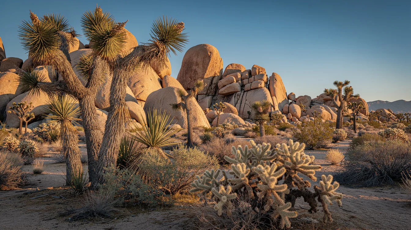
Joshua Tree National Park is where California’s Mojave and Colorado deserts meet. That collision gives you Joshua trees beside rounded granite formations, with one desert higher and cooler than the other.
And the park sits about 139.8 miles east of Los Angeles, close enough for a road trip from Southern California. But it feels far removed once the pavement runs between pale rock, dry washes, and trees with crooked arms reaching into the sky.
Two deserts share one park
Joshua Tree National Park brings together the Mojave Desert and the Colorado Desert. The Mojave sits higher and cooler, so Joshua trees thrive there; the lower Colorado side is hotter and drier, with more cactus and desert shrubs.
And that change can happen within the same drive. You may see the Joshua tree’s stiff, dark leaves against granite blocks, then enter a warmer stretch where the vegetation thins and the air feels sharper.
But the park is much larger than a scenic roadside stop. It covers about 792,510 acres, and more than 80 percent is managed as wilderness. My opinion: the best moments come when you stop chasing viewpoints and let the silence catch up.
For a broader California itinerary, you can pair the park with other California desert destinations. The contrast is useful because Joshua Tree rewards slow looking, not a rushed checklist.
Why the Joshua trees look so strange
The Joshua tree is actually a yucca, and the tallest examples can reach about 49 feet. Its branches twist upward in irregular shapes, making the trees look almost animated when the low sun throws their shadows across the ground.
And the trees take their time. They grow slowly after their first decade, and their flowering depends on rain arriving at the right moment, along with a winter freeze.
But you don’t need a botany lesson to understand their appeal. Stand among them near sunrise, when the leaves catch silver light and the granite turns pink, and the park feels stranger than its photographs suggest.
Granite, short walks, and big views
Hidden Valley is a strong first stop because a short hike leads through a pocket of boulders and desert plants. And the enclosed rocks make the route feel intimate, even though the surrounding park stretches for miles.
Keys View opens toward the Coachella Valley and, on clear days, the Salton Sea and distant mountains. But visibility changes, so don’t build your whole visit around a perfect horizon.
You can also visit Barker Dam, Skull Rock, or Arch Rock, each offering a different way to read the park’s granite. I prefer the rock formations late in the day, when the stone holds a little warmth and the shadows grow long.
And climbers come for traditional climbing and bouldering on the granite. If you only want to walk, you’ll still find plenty to do, though shade is limited and desert footing demands attention.
Can you visit without a long hike?
Yes. Several places are accessible with short walks, including Skull Rock and Cholla Cactus Garden. But bring water even for modest distances, because dry air can make you underestimate how quickly you are losing fluids.
When should you go?
The most comfortable period is generally October through May. And spring and fall usually offer the easiest conditions for walking, photography, and exploring the roads without fighting intense midday heat.
Winter days can be excellent for hiking and stargazing, but nights may bring frost or snow at higher elevations. Summer is a different proposition: daytime temperatures frequently pass 100°F, making long walks risky during the hottest hours.
But summer light can still tempt photographers. If you visit then, start at dawn, carry abundant water, and save strenuous activity for another season. That trade-off is real, and the desert doesn’t negotiate.
For more seasonal planning, check this guide to Palm Springs and the surrounding desert. The region is accessible, but comfort depends heavily on when you arrive.
Getting there means planning ahead
You can enter from Joshua Tree or Yucca Valley in the west, Twentynine Palms in the north, or Cottonwood from Interstate 10 in the south. And the nearby communities give you several practical bases, even though the park itself feels remote.
The Joshua Tree Visitor Center is near the town of Joshua Tree, while information centers also serve Twentynine Palms and Cottonwood. But mobile service can be absent or unreliable, so download maps and plan your fuel before driving deep into the park.
Joshua Tree first became a national monument in 1936, then a national park in 1994. You can feel that long history in the worn roads and old stonework, but the clearest reminder comes after dark.
And the night sky is one of the park’s finest rewards. Far from city lights, the Milky Way and constellations emerge above the black silhouettes of the trees, while the granite slowly disappears into shadow.
By the time the last light leaves the rocks, the desert is quiet enough to hear your own footsteps.