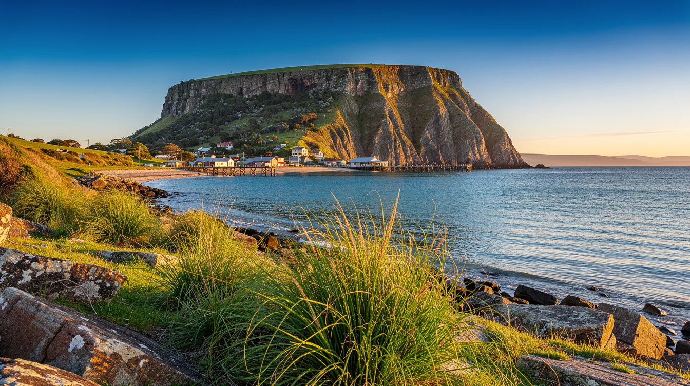
Stanley sits on Tasmania’s far north-west coast with a landmark that changes the whole arrival. The Nut, a flat-topped volcanic plug, rises 469 feet above Bass Strait, so the town feels watched over rather than merely arranged around a harbor.
You see it before you understand Stanley. The dark rise cuts against sea light and low farmland, and that odd geometry makes this fishing village feel more dramatic than its modest streets first suggest.
The 469-foot reason to stop in Stanley
And the title’s promise is literal: travelers come here for the climb beneath The Nut. The summit track is steep, but it earns its effort because the top opens into a 1.4-mile circuit above the town, beaches, farmland, and Bass Strait.
But you don’t need to hike if the chairlift is operating. That choice matters for travelers who want the view without the steep approach, though the walk gives you more time to feel the wind and hear the harbor recede below.
Late afternoon is the smart call. Softer light settles over the water, and Stanley’s white and weathered buildings look less like a museum display and more like a working town at the edge of a large, restless sea.
A fishing harbor, not a theme set
Stanley’s harbor still works as a fishing port, particularly for crayfish. That gives the waterfront an honest texture: boats, salt air, and the sense that dinner may have arrived by water rather than by delivery truck.
And that’s why the town works best at an unhurried pace. Walk the harbor, then move through the historic main streets, where colonial-era buildings remain part of the draw without turning every block into a costume drama.
But this isn’t a place for packed itineraries. You can eat Tasmanian crayfish when it’s available, linger over the sea view, and accept that the appeal lies in what Stanley doesn’t demand from you.
Stay after the day visitors leave
Overnight in Stanley is the decision I’d make. The town is particularly atmospheric in early morning and evening, when the day visitors have gone and the coast feels quieter under the changing Bass Strait weather.
And at dusk, look along the shoreline for penguins. There’s no promise of a private wildlife encounter, but the possibility changes the walk, especially when the air cools and the last light catches the water.
But bring layers and patience. Stanley’s weather can be moody, windy, and changeable, which is part of its character, though it can make a beach walk feel brisk even when the view is worth standing still for.
History has a sharper edge at Highfield
Highfield Historic Site adds context to the pretty streets. It was the former headquarters of the Van Diemen’s Land Company, and Stanley developed around that company in the early 1800s before taking its name from Lord Stanley.
And you should visit if the town’s tidy historic frontage starts to feel too easy. Highfield brings the colonial story closer, giving the coast a past that’s more complicated than the seafood-and-scenery version of Stanley.
But don’t rush from history straight back to the car. The contrast between the formal site and the active harbor is the point, because one explains how Stanley grew while the other shows what still keeps it grounded.
The practical case for a north-west detour
Stanley is about 78.9 miles west of Devonport, roughly a 90-minute drive. Public transport is limited, so you’ll want a rental car or your own vehicle if you’re building this into a Tasmanian road trip.
And late spring through early autumn is generally the most comfortable window for walks and coastal sightseeing. You can also use Stanley as a base for the Tarkine, Arthur River, and Tasmania’s wilder north-west coast.
But Stanley doesn’t need a long checklist to justify the detour. By evening, The Nut is still above the harbor, the wind is moving across Bass Strait, and the town has settled back into its own salt-scented rhythm.