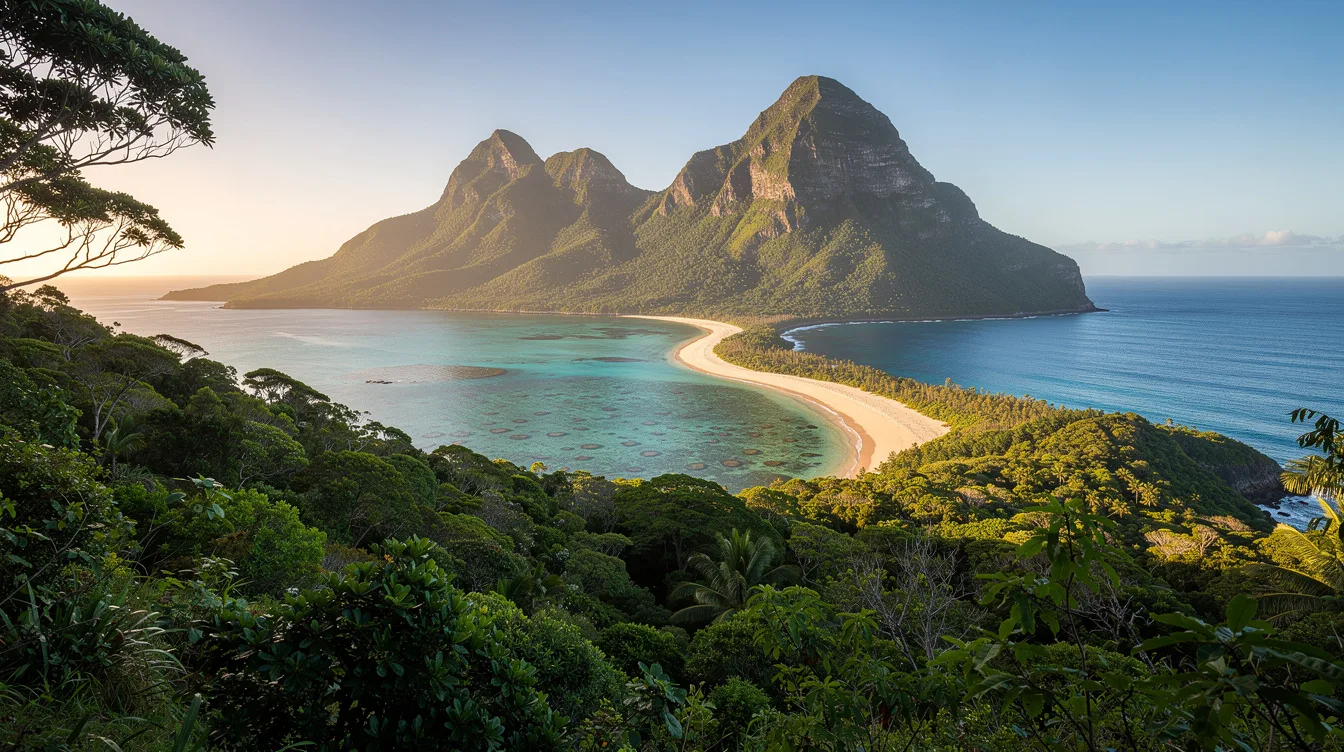
But Lord Howe Island is more than a far-flung Australian outpost. Seventy percent of its land sits inside a permanent protected reserve, while the surrounding group holds UNESCO World Heritage status for its global natural significance.
And that protection changes how the island feels. The developed lowlands stay compact, the southern hills rise into forest, and the western shore opens onto a sheltered coral lagoon. You come for the scenery, but the limits are part of the experience.
Why 70% of the island stays protected
But the reserve isn’t a label added for visitors. The Lord Howe Island Act 1981 established protection across about 70% of the island, keeping most of its forested interior outside the developed area.
And the island is small enough for that boundary to matter. Lord Howe stretches about 6.2 miles from end to end, but its width ranges from roughly 0.3 to 1.2 miles. You can cross between open shore and steep forest quickly, which makes the protected land impossible to ignore.
The group includes 28 islands, islets, and rocks. Seven uninhabited islets form the Admiralty Group to the north. The place is remote, but it isn’t shapeless or hard to understand.
For a closer look at the reserve, start with this Lord Howe Island guide. My opinion is simple: the protection gives the island its character, not merely its credentials.
A southern reef beneath Mount Gower
And the World Heritage recognition rests on more than forest. The Lord Howe Island Group contains the world’s southernmost barrier coral reef, set along a sandy, semi-enclosed lagoon on the western coast.
But the island’s most dramatic rise is inland. Mount Gower reaches 2,871 feet, forming the highest point above hills covered in forest. You don’t need a grand itinerary to understand the contrast, because the lagoon and mountain occupy the same compact island.
The area also protects plants and animals found nowhere else in the world. Nesting seabirds add movement above the water, while the marine park extends protection beyond the shoreline. The result feels lively, but never crowded by scale.
UNESCO lists the group for its natural significance, varied volcanic and oceanic geology, coral reef, seabirds, and historical heritage. Read more about World Heritage places in Australia before you plan a visit.
Getting there means committing to the distance
But Lord Howe isn’t a quick coastal detour. The island lies in New South Wales and out in the Tasman Sea.
And flights serve Sydney, the Gold Coast, Newcastle, and Port Macquarie. That gives you several departure points, although it doesn’t make the island ordinary. Check current flight schedules before booking, because the geography remains the main filter.
The island sits between Australia and New Zealand, yet it belongs to the Australian state of New South Wales. You arrive within a familiar national system, but the setting feels separated from the mainland by open water and distance.
On a practical note, the local currency is the Australian dollar, and the standard time zone is UTC+10:30. Daylight saving shifts it to UTC+11. Keep the logistics simple, then leave room for weather and transport changes.
Use the New South Wales travel guide to place Lord Howe in the wider state. The island rewards planning, but it punishes the idea that every detail will work like a mainland weekend.
What the island remembers
And the first reported European sighting came on 17 February 1788. Permanent settlement followed in June 1834, after the island had become a provisioning stop for ships moving through the Pacific.
But its history isn’t sealed off from the natural story. Whaling shaped the early economy, while the export of endemic kentia palms began in the 1880s and remains part of the island’s economic history.
Can you see the whole island in one visit?
You can understand its shape quickly, but you won’t exhaust it quickly. The island covers about 14.55 square kilometers, and less than 500 people live there, most of them in the north.
That small population changes the rhythm. The south is dominated by forested hills, the west by the reef lagoon, and the low-lying developed area occupies only a portion of the island. It feels inhabited, but not overbuilt.
Lord Howe Island’s trade-off is clear: reaching it takes commitment, and access depends on flights. In return, you get a protected island where Mount Gower rises behind a coral lagoon, and the forest begins close to the shore.