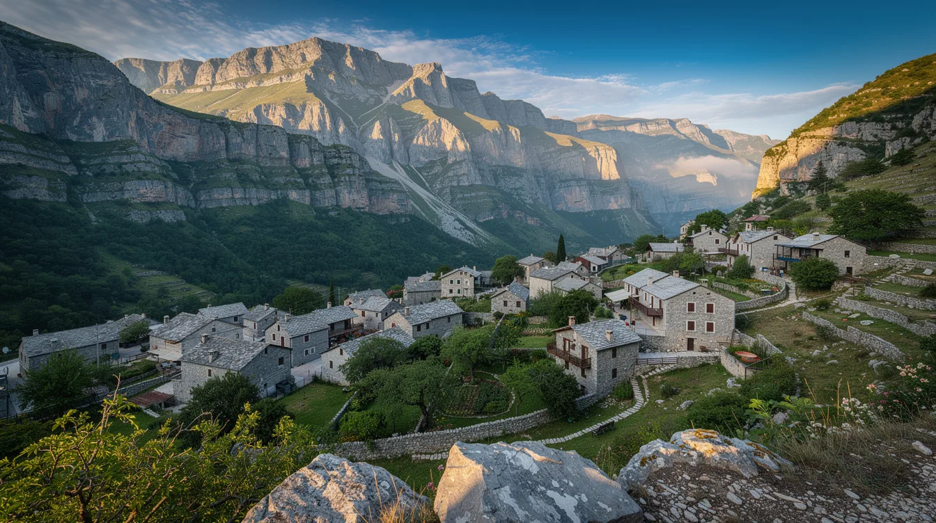
Papingo is really two mountain villages, Megalo Papingo and Mikro Papingo, gathered at the foot of the Tymphe massif in Greece’s Vikos-Aoös National Park. That split is the point of coming here. You don’t arrive for one tidy village square, but for a place that asks you to keep walking.
Megalo Papingo and Mikro Papingo sit within the same settlement, yet they give the visit a useful rhythm. Stone-built lanes, forest, and the snowy shape of Astraka peak make the setting feel close and steep. It’s tourist-facing, but the scale stays small.
Two villages, one mountain address
Megalo Papingo and Mikro Papingo are the greater and lesser halves of Papingo, both inside the national park. You can feel why they belong together: the mountain dominates both, and the route between them turns a simple stay into a walk with a destination.
And this is not a place to rush through between bigger Greek stops. The village is near the northern end of Vikos Gorge, while forests close in around the built-up streets. You’ll want time for the alleys and the changing angle of Tymphe overhead.
Mikro Papingo counted only 39 residents in the 2021 census, while Papingo counted 184. Those numbers explain the mood better than any promotional line could. There are places where quiet feels staged.
Here, it’s built into the population.
But don’t mistake small for empty of purpose. Hikers and mountaineers come from around the world, because the villages are a practical starting point for Tymphe. You may hear boots on stone before you hear much else.
A five-hour walk changes the scale
The real pull rises above the houses. A footpath heads through Tymphe’s sub-alpine plateaus toward Drakolimni, a glacial lake at 6,562 feet. The walk takes about five hours, so this is a mountain day, not an after-lunch diversion.
And that effort is exactly why the route works. You leave the compact village setting and move toward open high ground, with Astraka peak above and the sound of water replaced by wind. I’d choose this over trying to squeeze in every nearby sight.
Can you reach the refuge before the lake?
Yes. The Astraka mountain refuge sits at 6,398 feet on the route toward Drakolimni. It normally operates from May through October, which makes those months the sensible window if you want the trek with the refuge functioning normally.
But the refuge’s seasonal schedule matters. It has solar panels and can be used through the year by arrangement in winter, yet that is not the same as arriving unplanned. If you’re traveling outside its normal season, treat the mountain as a serious commitment.
Vikos-Aoös gives Papingo its edge
Vikos-Aoös National Park is more than a line on a map here. Papingo sits inside it, near Vikos Gorge, with streams, forests, pasture, sub-alpine grassland, and agricultural land across the wider area. You’re never far from a reason to look up or down.
The gorge is described as Greece’s largest and is noted for its depth-to-width ratio. Still, Papingo’s better quality is intimacy. The mountains feel huge, but the village streets keep the experience grounded in doorways, stone walls, and tavernas.
And there is a softer detour near the road between the villages. The Rogovos stream has cut limestone into the Kolymbethres, also called the Ovires of Rogovos, a series of rock pools. The water’s presence changes the feel of a dry stone setting.
You can find lodging, tavernas, coffee, and local spirits in Papingo. That’s enough, though not an argument for treating it like a resort. The appeal is that a meal or a room still feels connected to the walking outside.
Getting there is part of the decision
Papingo lies in Zagori, Epirus, 32.3 miles north of Ioannina. It is part of the municipality of Zagori, in the Ioannina regional unit. That distance gives you an anchor, but the mountain setting remains the reason to stay overnight.
And Papingo has been recorded since 1325, in a Byzantine imperial document. History is present here, though it doesn’t need to be turned into a museum exercise. The stronger impression comes from a settlement that has remained attached to difficult terrain.
The area gets heavy winter snow, with rain and humidity in other seasons. That is the trade-off behind the greenery and water. Plan around the refuge’s May-to-October season, then give yourself an unhurried evening after the trail.
By the time the light drops behind Tymphe, the stone lanes cool, Astraka disappears into shadow, and the two villages feel less separate than they did on arrival.