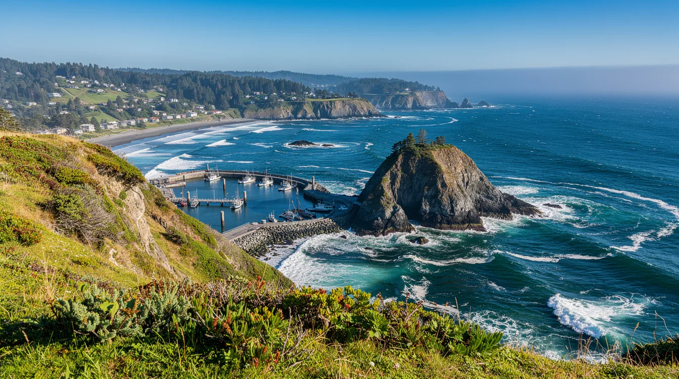
Port Orford has just 1,146 residents, yet it occupies an outsized edge of the map. At 124° 29′ 53″ west longitude, this Oregon community is the westernmost incorporated place in the lower 48.
You feel the point of that distinction quickly. The Pacific is not scenery here. It is the town’s working neighbor, close enough that the wind and weather set the day’s mood.
The far-west edge is a working harbor
The Port of Port Orford is the reason this small town feels different from a standard Highway 101 stop. It is an open-water dolly dock, where fishing boats are lifted from the sea by crane and stored on trailers instead of resting in a protected marina.
That arrangement makes the harbor worth watching in the morning. You may see vessels being launched or recovered, with engines, gulls, and the sharp salt smell doing more than any museum label could.
But this is not a polished waterfront built for browsing. The commercial fleet remains a real local industry, so the harbor has purpose, noise, and the occasional wait while work gets done.
Battle Rock gives you the fastest introduction
Battle Rock Wayside Park is the easy first stop, especially if you want to understand Port Orford before committing to a longer outing. The beach walk is simple, and the large offshore rock gives the shoreline a hard, dramatic focal point.
And you do not need a grand plan here. Walk slowly, look out at the water, then turn back toward town and notice how little development interrupts the coast.
Its appeal is not historic-pageantry. It is quieter and less built-up than many northern Oregon Coast towns, which means you get room to look, though fewer distractions when rain moves in.
Three nearby stops, each with a different mood
At Port Orford Heads State Park, the historic U.S. Coast Guard lifeboat station adds human scale to the exposed coast. You are looking at a place shaped by difficult water, not merely a scenic overlook.
North of town, Cape Blanco State Park has the 1870 lighthouse. The building supplies a clear reason to stop, while the cape itself delivers the larger argument: this section of coast feels open, windy, and happily unconcerned with your schedule.
Southbound, Humbug Mountain State Park brings coastal forest and hiking into the mix. And Redfish Rocks Marine Reserve offers ocean views, wildlife, kayaking, or diving when weather permits, though conditions get the final say.
Can you visit without a car?
Not comfortably. U.S. Route 101 runs through Port Orford, but a car is effectively essential if you want to move between the harbor, parks, and surrounding coast on your own terms.
The useful bearings are simple: Port Orford sits 27 miles south of Bandon and 28 miles north of Gold Beach. You can make it a stop between the two, but staying awhile makes more sense if quiet is the goal.
Weather decides the pace
This is a place to pack patience along with a rain layer. City figures put annual rainfall at about 74 inches, with December the wettest month and July the driest.
But wet weather is part of the deal, not a reason to skip it. The coast can feel raw and gray, then suddenly clear enough to make the offshore rocks and open water look almost severe.
You will not find a sourced “best time” to visit, and that is fair. Go when you can accept changing conditions, because Port Orford rewards flexibility more than fixed itineraries.
A small town that does not need to entertain you
There are galleries, fishing culture, and a small-town arts presence, but Port Orford’s best quality is restraint. It asks you to pay attention to a harbor crane, a headland, and the sound of wind hitting the shore.
And that is why the westernmost claim matters. By late afternoon, the road keeps moving north and south, while the Pacific stays directly in front of you, cold-looking and impossibly wide.