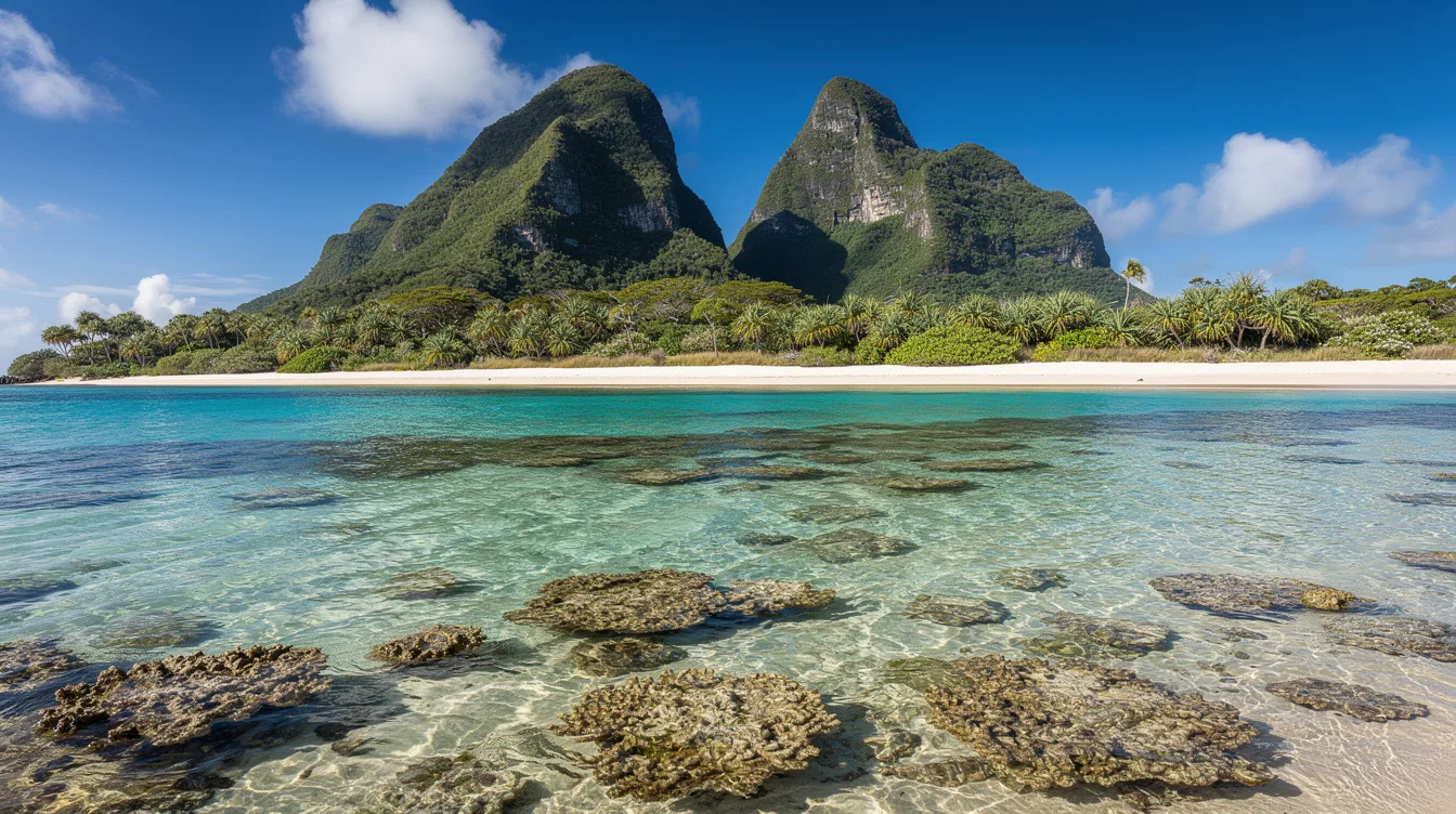
Lord Howe Island rises from the Tasman Sea with a 2,871-foot peak and the world’s southernmost barrier coral reef. The island group is also a UNESCO World Heritage Site, which makes this one of Australia’s rare places where the headline fact is genuinely hard to oversell.
And the contrast is immediate. Forested hills climb behind a sheltered coral lagoon, while fewer than 500 people live across the island. You can stand near the water and feel the salt on your skin, then look south toward Mount Gower and see why the island feels larger than its map suggests.
Why remoteness changes the mood
Lord Howe Island sits offshore. That distance keeps it remote, but it isn’t unreachable. Commuter airlines provide flights from Sydney, Gold Coast, Newcastle, and Port Macquarie, so you can reach the island without treating the journey like an expedition.
But the separation still matters once you arrive. The group includes 28 islands, islets, and rocks, and the main island is only 6.2 miles long. It narrows to between 0.3 and 1.2 miles wide, so the sea never feels far away.
And that compact shape gives Lord Howe a calm, self-contained rhythm. The developed area occupies only part of the island, while the south rises into forested hills. I prefer places that make you slow down without demanding hardship, and this island does exactly that.
You can read more about New South Wales before planning the trip. Just don’t expect a standard coastal getaway. The island’s scale is intimate, and its distance makes every arrival feel deliberate.
Mount Gower gives the island its vertical edge
Mount Gower reaches 2,871 feet, the highest point on Lord Howe Island. That height changes the view from almost anywhere on the low ground. The island’s crescent shape, coral lagoon, and surrounding sea come together beneath the summit.
And the mountain isn’t a decorative backdrop. It dominates the southern half of the island, where forested hills replace the easy openness of the developed north. You notice the shift in texture first, from sand and salt air to darker vegetation and steep ground.
Ball’s Pyramid, an uninhabited volcanic remnant, sits about 14.3 miles southeast of Lord Howe Island. The sight of another sharp piece of land offshore makes the whole group feel geological rather than resort-like.
But don’t confuse a high peak with an effortless outing. The supplied records establish the elevation, not trail conditions, walking times, or access rules. Check current local guidance before you plan around the summit, especially if your trip depends on a specific route.
The reef is the real reason to look west
The island’s western coast holds a sandy, semi-enclosed lagoon protected by coral reef. That sheltered water is where the central promise becomes visible: the Lord Howe Island Group has the world’s southernmost barrier coral reef.
And the reef changes the shoreline’s character. Instead of an exposed edge facing the full Tasman Sea, you get a calmer pocket where pale sand meets shallow-looking water and the wind seems to lose some of its force.
The marine area around the group is protected as the Lord Howe Island Marine Park. You can spend time at the water without needing a packed schedule, which is my preferred kind of island day. The reef supplies the drama, while the lagoon supplies the pause.
That said, the records don’t specify water temperatures, swimming conditions, or seasonal visibility. Don’t arrive with assumptions borrowed from tropical Australia. Lord Howe’s appeal comes from its position between worlds, and the water deserves the same respect as the mountain.
UNESCO protection keeps the wild character visible
UNESCO World Heritage status recognizes the group for its global natural significance. Much of the island remains virtually untouched forest, and some plants and animals occur nowhere else in the world.
But the island isn’t only a nature story. Its history includes a first reported sighting on 17 February 1788, permanent settlement in June 1834, and decades as a provisioning port for the whaling industry. Later, tourism and the export of endemic kentia palms shaped the local economy.
And you can feel that history in the way the island balances settlement with forest. Fewer than 500 residents share a place that protects distinctive wildlife, nesting seabirds, coral waters, and cultural traces. It is inhabited, but never urban.
For a wider look at World Heritage places, Lord Howe makes a persuasive case for visiting the quieter entries. The experience is less about collecting sights than noticing how little separates the village, the trees, and the sea.
What to know before you go
Lord Howe Island uses the Australian dollar and follows UTC+10:30, shifting to UTC+11 during daylight saving time. Airlines connect it with four Australian departure points, but the available notes don’t provide schedules, fares, or journey lengths.
And that uncertainty is useful to acknowledge. You can plan the broad shape of a visit around the reef, Mount Gower, and the island’s forest, but you’ll need current transport information for the details. The season also isn’t specified in the available records.
The best final image is simple: forested hills rising behind a sheltered coral lagoon, with the Tasman Sea beyond. By the time the light reaches Mount Gower, the island’s scale feels exactly right.