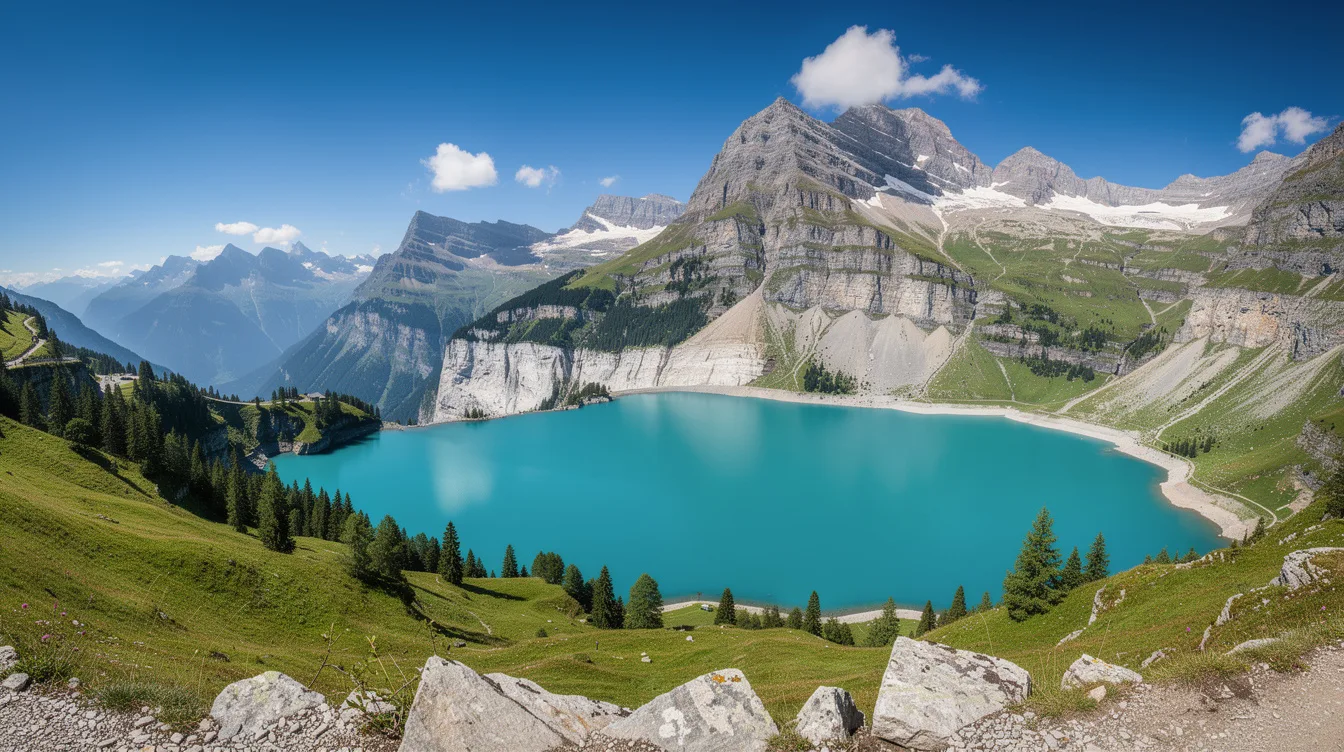
Kandersteg sits high in Switzerland’s upper Kander Valley, and its real appeal is simple: it is the main way into Lake Oeschinen beneath the Blüemlisalp massif. The village is quiet, but the mountains make it feel anything but small.
You come here for a lake, yet the approach matters almost as much. Kandersteg is in the Bernese Oberland and reachable by train via Spiez, so you can arrive without turning the trip into a mountain-driving test.
Lake Oeschinen is the reason to come
Lake Oeschinen lies east of Kandersteg at the foot of the Blüemlisalp massif. Its turquoise water is the headline, but the setting earns it: high rock walls and mountain slopes keep your eyes moving long after you reach the shore.
And this is the kind of place that makes an itinerary feel unnecessary. Walks around the lake can be gentle, while longer mountain routes head toward the Gemmi and Lötschen passes.
But don’t treat the lake as an automatic stop. The area below the Oeschinen Lake landslide scar has been closed, and some paths in the Oeschiwald trail network closed in July 2025 after rain brought runoff and debris flows.
That makes current conditions part of the trip, not an afterthought. Check access and trail status before setting out, especially after wet weather.
The Blüemlisalp keeps the scale honest
Blüemlisalp rises east of the village and reaches 12,018 feet. Lake Oeschinen sits at 5,177 feet, which explains why this is not a casual lowland lake day, even when the water looks inviting.
You feel the elevation in the cooler air and in the way clouds gather around the upper slopes. The climb is part of the experience, but it asks for more patience than a quick sightseeing detour.
And Kandersteg itself is already at 3,900 feet. That high starting point gives the village its mountain character without requiring you to begin from a resort built for crowds.
The contrast is appealing. It is tourist-oriented, yet its population was 1,288 in December 2020, so it still reads as a village rather than a stage set.
June through October is the lake window
June to October is the period for Lake Oeschinen, hiking, green valley views, and mountain lifts. If the lake is your priority, that is the stretch to plan around.
But late May and September can be quieter. You should check lift and trail availability, because mountain infrastructure may close temporarily during the shoulder season.
The village has a long relationship with visitors. Tourism began growing around 1850, and the railway line and Lötschberg Tunnel, built between 1906 and 1913, brought far more people into the valley.
That history matters because the rail connection still shapes the visit. Travel via Spiez, then continue to Kandersteg, and the town feels like a destination rather than a roadside pause.
Winter belongs to cross-country skiers
From December to March, Kandersteg shifts toward snow activities, ice climbing, snowshoeing, sledding, and cross-country skiing. The prepared classic and skating trail network totals around 37.3 miles.
And that is where Kandersteg has an edge over a busier resort base. You can spend a day moving through snow rather than circling shopping streets.
The cold changes the soundscape. Snow absorbs the noise, and the valley feels more enclosed beneath the surrounding peaks.
But winter visitors should be practical about conditions. Mountain weather and temporary infrastructure closures can alter a plan quickly, so flexibility is worth more here than a tightly timed schedule.
A small base with real mountain consequences
Kandersteg is a better choice than Interlaken for travelers who want a smaller, nature-led base with immediate access to serious alpine terrain. You trade resort bustle for a village framed by the Lötschen and Gemmi passes.
It also connects toward Valais on the historic Lötschberg route. Motorists can use the Kandersteg-Goppenstein car shuttle through the tunnel instead of driving over high mountain passes.
And there is a necessary caveat. Since 2018, officials have monitored instability at nearby Spitzer Stein, while researchers use GPS, radar, drones, and exploratory drilling to track the rock mass.
For visitors, the takeaway is not drama but attention. Follow official closures, let the conditions decide the day, and save room for the moment when Lake Oeschinen’s blue water appears below the Blüemlisalp.