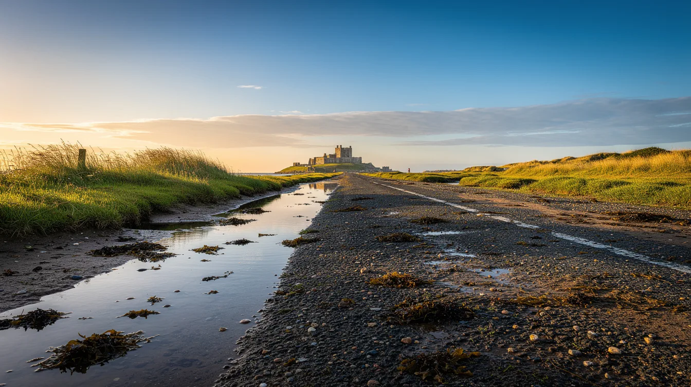
Holy Island, also called Lindisfarne, sits off England’s Northumberland coast near the Scottish border. Its road disappears beneath the sea twice a day, so getting here feels less like driving to an attraction and more like catching a brief opening in the day.
Only 151 residents live on the island. That small number matters because once the causeway closes, the village, harbor, and tidal sands feel separate from the mainland in a very literal way.
The road is the first thing you need to respect
The causeway is submerged twice daily, and it can become impassable quickly. You should check the published safe crossing times for your exact date before leaving, then check the return window too. A vague low-tide guess is how a relaxed outing turns into a long wait.
But this constraint is also Holy Island’s best trick. Cars arrive in a rush when the road opens, then the island settles again as the North Sea presses across the flats and cuts off the easy route home.
Plan to cross early, park in a designated island car park, and leave yourself a generous buffer before closing time. The island is often reachable for roughly five hours on either side of low tide, though the available window changes daily.
And don’t treat the road as a minor logistical detail. It determines the pace of the whole visit, which is why Holy Island works best when you stop trying to cram it into somebody else’s timetable.
AD 635 still shapes a very small village
A monastery was founded here in AD 635, making Lindisfarne a major center of Anglo-Saxon Christianity. The island is also tied to the Lindisfarne Gospels, among the finest surviving illuminated manuscripts from early medieval Britain.
You can begin at Lindisfarne Priory, where medieval ruins stand on the site of that earlier monastery. The stonework gives the place weight, but the open air keeps it from feeling sealed behind museum glass.
Beyond the priory, St Aidan’s Church and the compact village pull you back into the present. You’ll pass a harbor, lime kilns, dunes, saltmarshes, and broad tidal sands, with the wind carrying salt across nearly every stop.
But the island’s religious history isn’t its only story. A Viking raid traditionally dated to 793 made Lindisfarne part of a much darker chapter, and that tension still gives the quiet ruins their edge.
The castle earns the coastal walk
Lindisfarne Castle is a 16th-century coastal fort set on a volcanic rock outcrop. It has the sort of position that makes you pause before taking the next photograph, because the castle looks both exposed and entirely in command.
You can move from the village toward the coast after the priory. The route brings dunes, tidal sand, and huge North Sea skies into view, so the island feels larger than its village footprint suggests.
And the scenery is lively, but never loud. This is a place for watching the water change shape around the shore, not for chasing a packed schedule from one ticket desk to another.
Can you walk across the sands?
You can follow Pilgrim’s Way, a traditional pole-marked route across the sands, only when tide and weather conditions make it safe. Don’t attempt it on instinct. The route exists because the tides matter here, not because they can be ignored.
The surrounding Lindisfarne National Nature Reserve is important for migratory birds and other coastal wildlife. If you bring binoculars, the tidal flats reward patience, though you should still keep one eye on the crossing time.
Leave before the sea makes the decision for you
A practical order works well: priory first, then village and harbor, followed by the castle and a coastal walk. That sequence lets you see the island’s history before the open shore starts calling you away.
But don’t overpromise your day. The tide sets the terms, and the return road is not a suggestion. By the time the causeway vanishes under moving water, the harbor is quieter, the dunes are still, and Holy Island belongs to the sea again.