Tahiti does not whisper for attention. It absorbs it. Nearly seven out of every ten people in French Polynesia live on this single island. That concentration shapes everything, from flight schedules to dinner reservations two atolls away.
191,779 people, and everyone else passes through
The 2022 census counted 191,779 residents here. That is 68.7% of the entire territory’s population crammed onto one volcanic landmass. The next island over, Moʻorea, feels like a suburb by comparison.
Because Tahiti holds this majority, it also holds the jobs, the hospitals, the government offices, and the stores that stock what outer islands cannot. A family in Rangiroa needs a specialist doctor. They fly to Faʻaʻā. A farmer in Huahine wants to sell vanilla to an exporter. The buyer is in Papeʻete. The gravitational pull is constant.
And the population keeps climbing. The 2017 figure was 189,517. Growth is slow but steady, which means more cars on the coastal road, more pressure on the harbor, and more demand on the one airport that connects this nation of scattered islands to the rest of the world.
1,045 square kilometers of mountain and myth
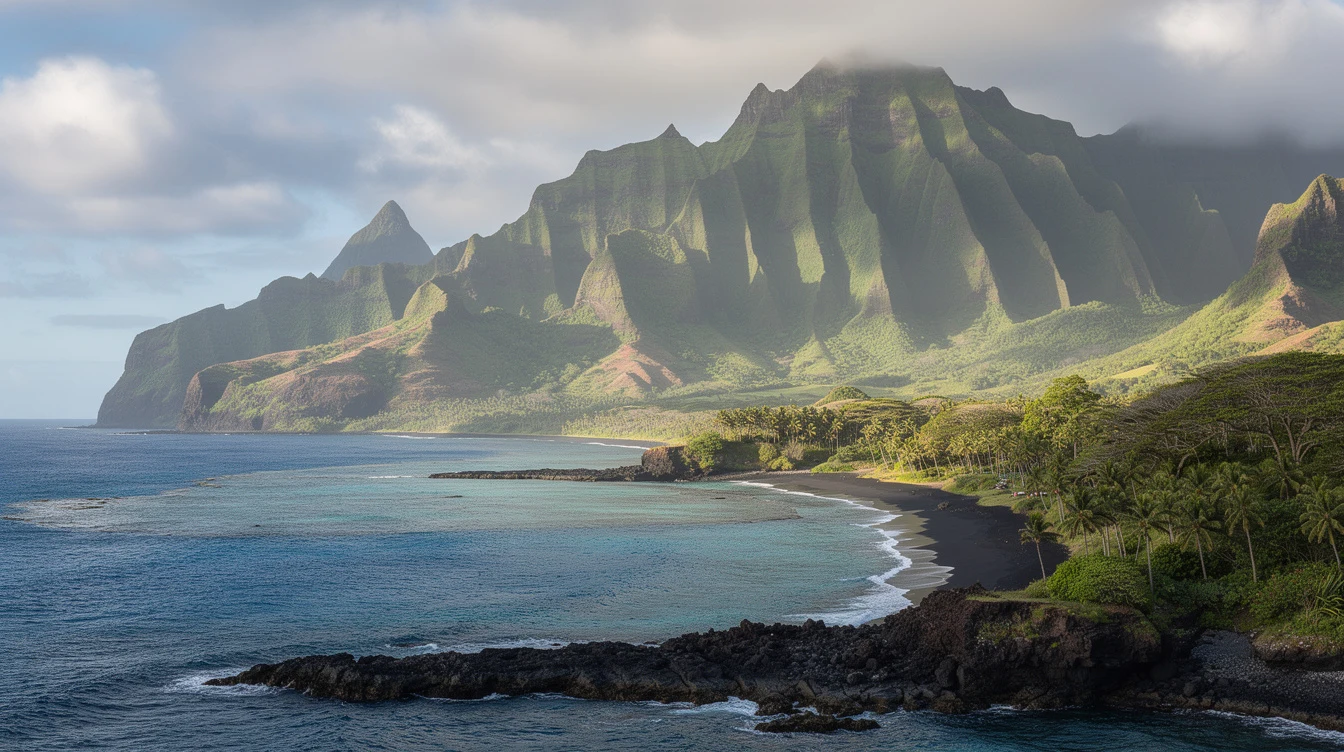
Tahiti covers 1,045 km², which makes it the largest island in French Polynesia by a wide margin. But size here is misleading. The interior of Tahiti Nui is almost entirely uninhabited. The mountains rise too steeply, and the valleys run too wild.
The island splits into two bodies joined by the Taravao isthmus. Tahiti Nui holds the capital and the crowds. Tahiti Iti, the smaller southeastern lobe, has remained isolated. Its far end, Te Pari, is reachable only by boat or on foot. No road cuts through. That is rare for an island this central.
And the terrain explains why development clings to a thin coastal strip. The mountains do not forgive expansion. They force people downward, toward the water, toward each other, toward the density that defines life here.
2,241 meters straight up from the Pacific
Mont Orohena tops out at 2,241 meters. That makes Tahiti the highest island in French Polynesia. The peak is not a technical climb, but it is a serious one. The trail gains elevation fast, and cloud cover can roll in without warning.
From the summit on a clear day, you see the full absurdity of the place. One island, one city, one road looping the coast, and beyond that nothing but ocean for thousands of kilometers. The height concentrates rainfall, which feeds the rivers, which carve the valleys, which keep the interior empty. Cause and effect, stacked to the clouds.
At the same time, the elevation traps moisture on the windward slopes. The Papenoʻo River runs thick and brown after rain. The Fautaua Falls near Papeʻete drop hard enough to hear from the road. Water is never far from mind here.
When should you actually go?
May to October. August is the driest month, with just 48 mm of rain recorded in Papeʻete. January, by contrast, dumps 340 mm. The wet season is not unlivable, but the trails turn slick and the mosquitoes multiply. Book the dry months if you want the mountains.
45 kilometers across, and nowhere to spread out
The island stretches 45 km at its widest point. That is not small. But the usable land is narrow. The coastal road squeezes between mountain and sea for most of its length. Traffic knots up around Papeʻete every weekday morning.
Because the terrain forbids sprawl, housing prices stay high and space stays tight. Families stack generations under one roof. The outer islands seem spacious by comparison, which is partly why some Tahitians dream of retiring to somewhere quieter, and partly why they never do. The jobs are here. The children are here. The ferry to Raivavae takes days.
And the width of the island matters for another reason. It is small enough to cross in an afternoon, but large enough to contain worlds. The surf breaks on the south shore differ completely from the lagoon calm of the west. A driver can leave Papeʻete in rain and reach Taravao in sun twenty minutes later.
4,400 kilometers from anywhere you have heard of
Tahiti sits 4,400 km south of Hawaiʻi. The nearest major landmass is New Zealand, still 3,800 km to the southwest. Chile is 7,900 km away. Australia, 5,700 km. These numbers are not trivia. They explain the island’s role.
In a territory this scattered, isolation demands a hub. Every flight from Paris, Los Angeles, or Auckland lands at Faʻaʻā International Airport. From there, travelers fan out to Bora Bora, to Rangiroa, to the Marquesas. But the funnel is always here.
The airport is the only international gateway in a collectivity of 121 islands and atolls. That fact alone guarantees Tahiti’s dominance. No matter how famous Bora Bora’s lagoon becomes, the path to it runs through this island first.
By the time the last domestic flight lands at Faʻaʻā, the terminal empties fast. The mountain swallows the sunset. And the island keeps breathing, 191,779 strong, the lung that oxygenates an ocean of scattered rock.