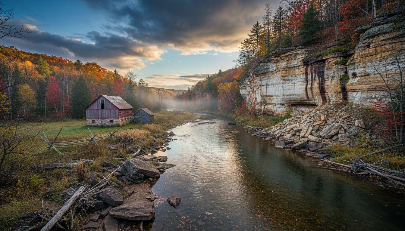
Morning mist rises from the Kickapoo River, revealing limestone bluffs that glaciers never touched. While ice sheets flattened the surrounding Midwest 10,000 years ago, this 10,000-square-mile region escaped their reach. The Driftless Area stands as Wisconsin’s geological anomaly, where ancient river valleys carve through 500-million-year-old bedrock just 60 miles from Madison. Here, 150,000 residents preserve farming heritage dating to the 1820s in a landscape that defies every Midwest stereotype.
The valley system glaciers couldn’t flatten
The name tells the story: “driftless” refers to the absence of glacial drift, the rock debris ice sheets leave behind. During the Late Wisconsin Glaciation 30,000 years ago, ice flowed around this southwestern Wisconsin region, deflected by highlands to the north.
According to geological surveys, the Driftless Area spans counties including Crawford, Vernon, Richland, Grant, Iowa, and Sauk. Towering bluffs rise 600-1,200 feet from valley floors, their stratified faces revealing millions of years of sediment layers. These dramatic elevations rival mountain regions found hours away.
The Wisconsin, Kickapoo, and Mississippi Rivers wind through narrow valleys, creating a maze of waterways that supported ancient cultures seeking winter shelter. Regional archaeological records confirm this area’s long history as a natural refuge.
Where ancient bedrock meets prairie architecture
Limestone cliffs that glow golden at sunset
The Driftless Area’s visual signature emerges from Ordovician bedrock exposed by millennia of river erosion. At Devil’s Lake State Park, sandstone formations frame turquoise water, while the Great River Road showcases limestone bluffs catching afternoon light. Blue Mound State Park, at 1,719 feet, offers panoramic views across this unglaciated terrain from coordinates 43.025891°N, -89.844618°W.
Frank Lloyd Wright’s architectural response
Wright built Taliesin near Spring Green in 1893, his Prairie School designs echoing the horizontal limestone strata. The National Historic Landmark demonstrates how architecture can respond to geological formations. Tours cost $25-40, revealing how Wright incorporated local sandstone and designed rooflines that mirror bluff profiles. This architectural heritage shares similarities with other river valley landmarks shaped by ancient geology.
Experiencing Wisconsin’s geological time capsule
Spring-fed trout streams and world-class fishing
Local fishing guides confirm the Kickapoo River maintains 50-55°F temperatures year-round, supporting brook, brown, and rainbow trout in waters that haven’t been degraded by agricultural runoff. Canoe rentals cost $30-50/day, providing access to stretches where spring-fed tributaries create ideal fishing conditions.
The region’s 1.2 million annual visitors spread across 10,000 square miles, meaning solitude comes easily. Rock climbing at Devil’s Lake costs $75-120 for guided experiences, while hiking remains free in state parks.
Farm-to-table heritage rooted in 1820s settlements
Dodgeville’s artisan cheese cooperatives trace their roots to Welsh and Cornish immigrants who arrived during the 1820s-1840s lead mining boom. These agricultural traditions mirror farming communities that maintained their heritage across generations. Viroqua’s Saturday farmers market showcases orchard-fresh apples and morning trout catches, with casual meals costing $15-25 and upscale farm-to-table dining ranging $30-50.
Beyond Madison’s shadow into geological wonder
While Chicago sits 220 miles southeast, the Driftless Area remains overlooked precisely because it contradicts expectations. This isn’t corn-covered flatland, but vertical drama created by ancient rivers. Fall foliage peaks from late September through early October, when maples and oaks ignite hillsides in crimson and gold.
Accommodation ranges from $80-120/night for B&Bs and cabins to $200-350/night for luxury lodges. The unhurried pace and authentic character attract travelers seeking landscapes unmarked by commercial tourism.
Winter brings cross-country skiing through silent valleys. Spring delivers wildflower carpets across bluff slopes. Summer means river paddling past farmsteads established when lead mining drove settlement patterns that persist today.
Your questions about the Driftless Area answered
How do I reach this unglaciated region?
Fly into Madison’s Dane County Regional Airport (MSN), then rent a car for $45-70/day. Major highways including I-90, I-39, and US-14 provide access to gateway communities like Spring Green, Dodgeville, and Viroqua. Driving times from Madison range from 60-90 minutes to reach the region’s heart.
What makes this landscape geologically unique?
The Driftless Area represents the only unglaciated terrain between the Appalachians and Rockies. While surrounding states were flattened by ice sheets, this region preserved pre-glacial topography including deeply carved river valleys and towering bluffs reaching 1,200 feet. The absence of glacial drift created landscapes unchanged for millions of years.
When should I visit for optimal conditions?
Late September through early October delivers peak fall foliage when hillsides glow with autumn colors. May-June offers spring wildflowers and mild 40-60°F temperatures. Winter brings snowshoeing and cross-country skiing opportunities, while summer provides ideal conditions for river paddling and trout fishing in 65-80°F weather.
Sunset gilds limestone cliffs as the Wisconsin River reflects copper light. In valleys the glaciers missed, ancient bedrock tells stories predating human settlement. No tourist industrial complex. No manufactured attractions. Just 500 million years of patient erosion, preserved by geological accident and protected by residents who never needed marketing to understand their treasure.
