I still remember the morning I stood at Lake Coatepeque’s edge, watching the water shift from deep sapphire to electric turquoise in less than 48 hours. The locals call it Cerro de las Culebras — Hill of Snakes — and this volcanic caldera holds a secret that only reveals itself a few times each decade. When the transformation happens, the entire 25.3 km² lake becomes something out of a fever dream.
What I didn’t expect was discovering that this phenomenon occurs in the only volcanic crater lake in Central America where documented color changes happen with such dramatic regularity. Between 1998 and 2019, scientists recorded multiple transformations, each lasting just days before the lake returned to its crystalline blue.
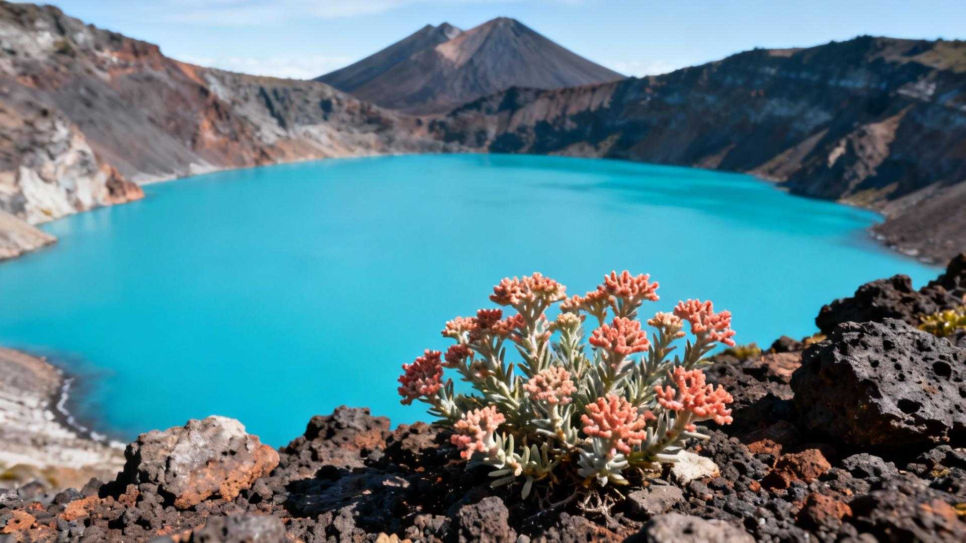
This isn’t Lake Atitlán with its crowds and Instagram hordes. This is 745 meters of elevation wrapped in volcanic drama, where three volcanoes — Santa Ana, Izalco, and Cerro Verde — form a natural amphitheater around waters so clear you can see 15 meters down on calm days.
The color-changing mystery scientists still debate
When volcanic sediment meets seasonal rains
The transformation begins each June when seasonal freshwater rains stir up volcanic minerals deposited at the lake’s 115-meter depths. As these particles rise, they trigger an algae bloom involving three specific species: Microcystis aeruginosa, Oscillatoria limosa, and Ceratium furca. The algae absorb blue light wavelengths, leaving only turquoise visible to the human eye.
The only Central American lake with satellite-documented transformations
Copernicus Sentinel-2 satellites captured the August 24 color change, providing scientific documentation that earned Lake Coatepeque runner-up status as the eighth wonder of the world. While theories range from optical illusions to agricultural runoff, the phenomenon remains partially unexplained — which makes witnessing it feel like stumbling onto nature’s best-kept secret.
Isla Teopán reveals 2,000 years of Mayan history
The partially submerged volcanic cone hiding ancient treasures
Rising 180 meters above the lake’s surface to 929 meters elevation, Isla Teopán holds archaeological deposits dating to 400-100 BC. In early 1996, construction workers uncovered a potbelly sculpture covered by over one meter of soil, revealing ceramic sherds from the Chul and Caynac complexes of western El Salvador’s Late Preclassic Maya period.
Walking where ancient civilizations witnessed the same color changes
The island’s archaeological site proves that Maya communities lived here 2,400 years ago, likely witnessing the same turquoise transformations we see today. Local guides share stories passed through generations about the “snake mountain” — a name that predates Spanish colonization by centuries.
Three volcano hikes surround the lake’s perfect microclimate
Year-round 75°F temperatures at volcanic elevation
Unlike Chile’s Valle de la Muerte where desert extremes dominate, Lake Coatepeque’s elevation creates a perpetual spring climate. The volcanic caldera traps cool air while surrounding peaks block harsh weather systems, maintaining comfortable temperatures even during El Salvador’s wet season from May through October.
Accessing three volcanoes from one lakeside base
Santa Ana volcano offers 2-hour summit hikes to an active crater lake, while Izalco’s perfectly conical profile provides 4-hour round-trip ascents through volcanic ash fields. Cerro Verde National Park connects all three peaks with trails that reveal why this geological amphitheater creates such unique water conditions below.
Practical advantages over Guatemala’s overcrowded Lake Atitlán
Seventy percent fewer crowds with superior water clarity
Lake Atitlán attracts 2 million annual visitors to its 130 km² surface, creating boat traffic and shoreline development that clouds the water. Lake Coatepeque’s smaller 25.3 km² size and nationally protected status preserve the pristine conditions that make color changes visible. I found lakeside guesthouses charging $30-50 per night compared to Atitlán’s $150-300 resort rates.
Activities impossible at larger Central American lakes
The combination of volcanic depth and clarity enables scuba diving to 30+ meters where you can explore submerged volcanic formations. Like Cape Verde’s volcanic crater swimming experiences, kayaking across Coatepeque during color-change periods creates otherworldly sensations as turquoise water reflects volcanic peaks.
Planning your visit for the next color transformation
June through August 2026 offers the highest probability
The Coatepeque Foundation monitors water conditions and alerts visitors when transformations begin. Book accommodations in advance during these months, as lakeside rooms fill quickly once word spreads. The dry season from November through April provides ideal conditions for volcano hikes when color changes aren’t occurring.
Cultural respect ensures future generations witness this phenomenon
Local fishing communities depend on Lake Coatepeque’s ecosystem remaining healthy. During algae blooms, respect fishing bans established by the National Red Tide Commission. Support locally-owned guesthouses over international chains, and consider hiring Salvadoran guides who provide cultural context the guidebooks never mention.
Standing beside waters that shift from blue to turquoise within 48 hours changes how you understand volcanic geology. This isn’t just a pretty lake — it’s a living laboratory where ancient Maya civilizations intersect with modern scientific mysteries.
And unlike Lake Atitlán’s tourist saturation, Lake Coatepeque still belongs to the locals who call it home. Visit before the secret spreads beyond those who know to look.
Essential questions about visiting Lake Coatepeque
How do I reach Lake Coatepeque from San Salvador?
The lake sits 90 minutes west of Monseñor Óscar Arnulfo Romero International Airport via Route 8A. Rental cars cost $25-35 daily, while private shuttles charge $60-80 round-trip. Public buses run hourly from Terminal de Occidente for $2 but require transfers in Santa Ana.
When does the lake change colors most reliably?
Color transformations occur most frequently during June, July, and August when seasonal rains stir volcanic sediment. However, the phenomenon remains partially unpredictable — the lake changed four consecutive years recently but skipped several years prior. Contact the Coatepeque Foundation for real-time water monitoring updates.
Can I visit Isla Teopán’s archaeological site?
The island remains partially restricted to protect archaeological deposits, but local boat operators offer guided circumnavigation tours for $15-20 per person. Organized archaeological tours require advance permission through El Salvador’s Ministry of Culture, typically granted for educational or research purposes.
What’s the best season for volcano hiking around the lake?
November through April’s dry season provides optimal hiking conditions with clear summit views. Santa Ana volcano requires park entry fees of $6 plus mandatory guide services ($10-15 per group). Start hikes before 8 AM to avoid afternoon cloud cover that obscures crater lake views.
Are there sustainable tourism options around Lake Coatepeque?
Several family-run guesthouses practice sustainable tourism, including solar power and greywater recycling. Look for accommodations affiliated with the Coatepeque Foundation’s conservation programs. Avoid jet ski rentals during algae bloom periods, and support local fishing cooperatives that maintain traditional sustainable practices passed through generations.