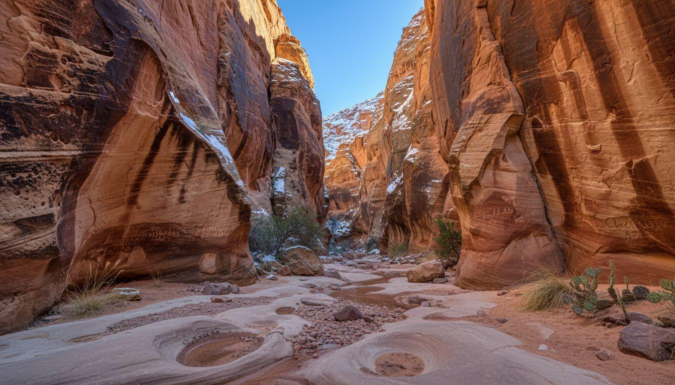
Morning light filters through towering red sandstone walls as you approach Capitol Gorge trailhead. The parking area sits empty except for a ranger’s truck and two cars with Colorado plates. This narrow canyon wash cuts through Capitol Reef’s Waterpocket Fold, offering slot canyon drama without permits or crowds. December snow dusts the rim 400 feet above, creating what locals call the “powdered sugar effect” on iron-stained rock.
Unlike Antelope Canyon’s $80 guided tours or Zion’s permit chaos, Capitol Gorge delivers accessible wonder. The 4.5-mile moderate hike follows a clear ephemeral wash where Mormon pioneers carved their signatures into living stone. Winter visits drop 7% from the park’s 1.2 million annual visitors, leaving you with cathedral silence and crisp 47°F highs.
Pioneer signatures carved into canyon walls tell 150-year-old stories
The Pioneer Register appears 0.8 miles from the trailhead, carved 15-20 feet above the wash floor. Names like “A.F. Bronson 12-15-10” and “J.A. Call 1882” mark where Mormon settlers documented their passage through the Waterpocket Fold. These inscriptions served as the area’s guestbook when Capitol Gorge functioned as the main road until 1962.
Six surveyors from 1911 left detailed signatures alongside wagon travelers from the 1880s. Winter light enhances inscription visibility, with 10am-2pm offering optimal contrast. The sandstone preserves every chisel mark, creating an outdoor museum of westward expansion.
What makes these inscriptions special
Unlike protected museum displays, you can photograph these signatures up close. The original wagon road passed directly beneath them, making this spot a natural rest area. Mormon pioneers used steel tools to carve deep letters that remain razor-sharp 140 years later.
Finding Fremont petroglyphs nearby
Wooden posts mark Fremont culture petroglyphs dating to 600-1300 AD. These ancient symbols appear 0.5 miles past the Pioneer Register, requiring careful searching among smooth canyon walls. Bighorn sheep and anthropomorphic figures show how different cultures used this same corridor across centuries.
Canyon walls narrow to shoulder-width passages
The gorge tightens dramatically past mile 1.5, creating true slot canyon conditions. Walls rise 400+ feet while narrowing to 10-15 feet across. Navajo Sandstone layers tell geological stories spanning 20 million years of erosion and uplift.
Flash flood channels carved these narrows during the Laramide Orogeny 50-70 million years ago. The Waterpocket Fold’s monocline structure creates a 100-mile wrinkle in Earth’s surface, visible from space. Winter conditions make flash flooding unlikely, but ice patches require traction devices on smooth rock.
Walking through geological time
Crossbedding patterns in the canyon walls show ancient sand dune formations. Each layer represents different climate periods when this area alternated between desert and shallow sea. The red coloration comes from iron oxide coating individual sand grains.
Tank formations hold seasonal water
Natural potholes called “tanks” appear in the canyon floor 2 miles from the trailhead. These depressions collect snowmelt and rare precipitation, supporting desert ecology. Winter often leaves them dry, but spring snowmelt creates temporary pools.
This route connected pioneer communities across impossible terrain
Capitol Gorge served as the only wagon route through the Waterpocket Fold from the 1880s through 1962. State highway crews finally blasted an alternate route, leaving this natural corridor to hikers. The canyon pinches to impassable conditions 2.2 miles from the trailhead, marking where wagons turned back.
Butch Cassidy’s Wild Bunch gang reportedly used nearby Robbers Roost as a hideout, with Cassidy Arch trail accessible 2 miles via Grand Wash. This connection between outlaw history and pioneer settlement shows how isolation both protected and challenged early residents.
According to National Park Service records, wagon travel required 3-4 days to navigate what visitors now hike in 3 hours. Winter snow occasionally blocked the route for weeks, forcing detours of 100+ miles around the Waterpocket Fold.
Your questions about Capitol Gorge answered
How does Capitol Gorge compare to other Utah slot canyons?
Capitol Gorge offers self-guided access without permits, unlike Zion Narrows ($35 entry plus shuttle). Antelope Canyon requires $50+ guided tours with timed tickets. Capitol Gorge costs nothing beyond park entry ($15 for 7 days or $80 annual America the Beautiful Pass).
What’s the best time to visit for photography?
Winter provides optimal conditions with clear skies, minimal crowds, and snow-dusted rim views. Golden hour occurs 3-4pm in December. Pioneer inscription visibility peaks during midday sun (10am-2pm) when shadows create maximum contrast against smooth sandstone.
Is the trail suitable for families with children?
The moderate wash hike works for ages 8+ with proper preparation. No technical climbing required, but loose gravel demands sturdy shoes. Carry 2 liters of water per person even in winter. Trail has no shade, making early morning starts essential during warmer months.
Ravens echo through the canyon silence as afternoon shadows lengthen across red walls. Pioneer signatures catch the last light, their carved stories bridging 150 years of human passage through this geological wonder.