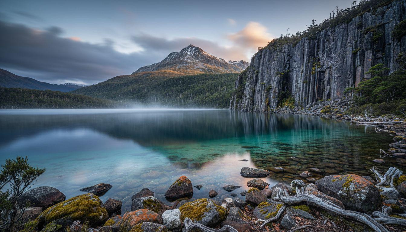
At 737 meters above sea level, morning mist rises from Lake St Clair’s glacial depths like whispered secrets from ancient ice. Australia’s deepest freshwater lake stretches 9 miles through Tasmania’s Central Highlands, its 705-foot depths carved by glaciers over two million years. The traditional Aboriginal name “leeawuleena” means “sleeping water.” While Cradle Mountain draws 265,000 annual visitors 50 miles north, this overlooked southern terminus offers authentic wilderness. Just 108 miles from Hobart, yet worlds away from tourist crowds.
Where ancient ice carved Australia’s deepest waters
Lake St Clair fills a valley deepened by multiple glaciations, where retreating ice left moraine dams that trapped meltwater in a basin now 705 feet deep. No other Australian lake reaches such depths. The elongated form stretches 9 miles by 1 mile, surrounded by peaks reaching 5,305 feet.
Sheer dolerite cliffs rise 650 feet from the water’s edge. Their dark blue-grey surfaces catch shifting light throughout each day. The lake sits at Cradle Mountain-Lake St Clair National Park’s southern boundary, occupying 17 square miles of surface area.
Mount Olympus dominates the northern skyline at 4,747 feet. Its summit reflects in waters that stay 50-54°F year-round. This temperature testifies to the lake’s glacial origins, where ice-carved landscapes preserve ancient climate patterns.
What makes Lake St Clair Tasmania’s hidden wilderness
Unlike Cradle Mountain’s commercialized infrastructure, Lake St Clair preserves authentic wilderness character through minimal development. The Cynthia Bay visitor area provides essential services without overwhelming natural character. A single restaurant, basic lodges, and walking track access maintain the area’s quiet dignity.
The Overland Track’s southern terminus means hikers arrive grateful rather than tourist-bus crowds seeking photo opportunities. Water clarity allows visibility several meters deep, where turquoise shallows transition to indigo where depths plunge beyond 300 feet.
The dolerite cliffs that rise 650 feet
Morning light transforms these grey-blue rock faces into sculptural forms. Their vertical surfaces catch sun while valleys remain shadowed. The cliffs create a fjord-like atmosphere rare in Australian landscapes, where vast empty spaces define authentic wilderness experiences.
Aboriginal heritage and “sleeping water”
Vegetation patterns reveal Aboriginal burning practices spanning thousands of years. This isn’t pristine wilderness discovered by Europeans but carefully managed cultural landscape. The Larmairremener tabelti people maintained relationships with this water for millennia before William Sharland’s 1832 arrival.
Walking the edge of Australia’s deepest lake
The Shadow Lake circuit covers 8 miles in 4-5 hours, traversing sub-alpine moorlands before circling remote Shadow Lake. It returns past Watersmeet where the Hugel and Cuvier Rivers cascade into Lake St Clair at Platypus Bay. Difficulty rates intermediate to advanced with 1,115-2,295 feet elevation gain depending on route variation.
The Echo Point to Cynthia Bay walk follows 6 miles of the Overland Track along the lake’s edge. This route offers continuous water views and ancient forest. It begins via 20-minute boat transport across the lake to Echo Point jetty.
The Shadow Lake circuit and Watersmeet
The meeting point of rivers creates dynamic water energy contrasting with Lake St Clair’s mirror-still surface. Platypus sightings occur regularly in early morning hours. High-altitude aquatic experiences like these offer rare encounters with Australian wildlife in pristine settings.
Boat transport and water perspectives
Ferry crossings cost $31-39 provide scale perspective impossible from shore. Dolerite cliffs appear even more massive when viewed from water level. The distinctive experience of viewing surrounding mountains from water creates unique photographic opportunities where geological time becomes tangible.
The light that transforms glacial water
Autumn light from March-May proves superior to summer’s harsh midday glare. Lower sun angles during morning hours and early evening create dramatic cliff illumination. Eastern faces catch golden dawn while western cliffs glow amber at sunset.
The water surface acts as mirror during calm conditions, doubling the visual impact of surrounding peaks. November’s transitional season offers advantages: daylight extends to 9:00 PM, temperatures remain mild at 54-59°F, and tourist numbers stay moderate. The distinctive chromatic shift occurs throughout each day, where natural light transforms landscapes into living artwork.
Your questions about Lake St Clair answered
When should I visit and what does it cost?
November through April offers practical hiking weather, but March-May provides optimal conditions. Mild temperatures of 50-59°F, stable weather, lower tourist density, and superior autumn light quality define this period. Parks passes cost $15 daily or $77 annually. Accommodation ranges from $16-29 camping to $193-322+ premium lodges. Boat transport costs $26-39.
How does it compare to Cradle Mountain?
Lake St Clair receives substantially fewer visitors than Cradle Mountain’s 265,000 annually, offering genuine solitude. The southern location means fewer crowds while geological features provide unique rather than duplicated experiences. Australia’s deepest lake at 705 feet offers distinctive wilderness encounters. Accommodation availability increases significantly compared to northern park areas.
What makes the Aboriginal heritage significant?
The traditional name leeawuleena represents thousands of years of Larmairremener tabelti relationship with this landscape. Vegetation patterns reveal Aboriginal burning practices. This isn’t wilderness discovered by Europeans but cultural landscape actively managed for millennia. Archaeological evidence shows sophisticated landscape stewardship spanning thousands of years before European arrival in 1832.
Evening light catches Mount Olympus reflected in mirror-still water while dolerite cliffs turn amber-gold. The thermometer reads 54°F as mist begins rising from glacial depths at 705 feet below. Silence settles across waters where ice carved truth into ancient stone. This is Tasmania’s overlooked masterpiece, hiding in plain sight.
