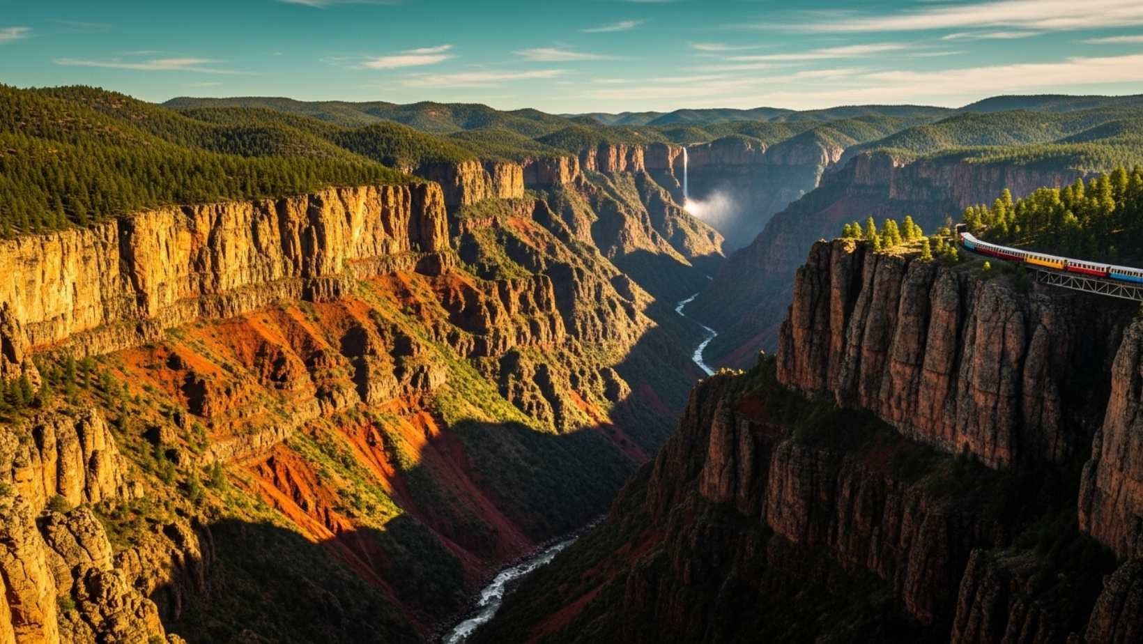
Most travelers fixate on Arizona’s famous gorge while a Mexican canyon system four times larger sits just south of the border, plunging 1,000 feet deeper in sections and decorated with waterfalls that the American landmark can’t match. The Chihuahua desert conceals this geological masterpiece where copper-tinted walls shift from burnt orange to deep crimson depending on the angle of sunlight.
I discovered this place during October when the temperature hovers around a perfect 70°F, and the local Tarahumara women sell freshly made gorditas at every train stop. The aroma of mesquite-grilled meat mixed with pine forest air creates an olfactory experience that stays with you long after departure.
This network of six interconnected canyons covers 25,000 square miles of Sierra Madre Occidental terrain. While tourists crowd viewpoints in Arizona, these Mexican gorges offer solitude and drama that redefines what a canyon experience should be.
You’ll witness depths that make the Grand Canyon look shallow
The Urique Canyon section drops 6,165 feet from rim to river, surpassing the Grand Canyon’s deepest point by more than 1,000 feet. Standing at the edge, you can see layers of volcanic rock dating back 20 million years, each stratum telling a different geological story. The sheer vertical drop creates microclimates where tropical plants thrive at the bottom while pine forests blanket the rim.
Local guides told me that temperatures can vary by 40°F between canyon floor and rim, creating bizarre weather patterns. I once watched rain falling in the depths while standing in bright sunshine above. The copper and green mineral deposits that give the canyons their name create walls that literally change color throughout the day, from pale gold at dawn to deep rust at sunset.
The Batopilas Canyon reaches depths of 5,904 feet, while Sinforosa Canyon plunges 5,900 feet. These measurements dwarf most North American gorges, yet somehow this place remains relatively unknown to international travelers. During my visits, I’ve encountered more Mexican families on vacation than foreign tourists, which speaks volumes about how well this secret has been kept.
The scenic railway journey rivals Switzerland’s mountain trains
The Chihuahua al Pacífico railway, known as El Chepe, traverses 406 miles through this canyon system, crossing 37 bridges and passing through 86 tunnels. This engineering marvel took 90 years to complete, finally opening in 1961. The train climbs from sea level to 8,071 feet, offering perspectives that simply don’t exist from canyon rim viewpoints.
I’ve ridden this train six times, and each journey reveals something new. The dining car serves carne asada that rivals any restaurant in Mexico City, prepared by a chef who’s worked this route for 23 years. He sources beef from ranchers along the route, ensuring the meat is never more than two days from the ranch. The coffee comes from Chiapas, strong enough to keep you alert for the 16-hour journey.
Large windows frame views that change every few minutes. One moment you’re passing through pine forests where Tarahumara villages dot the hillsides, the next you’re suspended over a gorge so deep the river below looks like a silver thread. Similar to Chile’s otherworldly desert landscapes, the terrain here defies expectations.
Waterfalls cascade directly into canyon depths alongside indigenous communities
Basaseachic Falls drops 807 feet in a single plunge, making it Mexico’s second-highest waterfall. Unlike tourist-packed cascades elsewhere, you can often stand at the viewpoint completely alone, watching water turn to mist before reaching the rocks below. During rainy season from July through September, the falls swell to three times their dry-season width.
The Tarahumara people, who call themselves Rarámuri (meaning “those who run fast”), have inhabited these canyons for over 2,000 years. They’re renowned for running ultra-marathon distances in simple sandals made from old tire treads. I once watched a Tarahumara man in his sixties run down a canyon trail that took me three hours to hike, reaching the bottom in 45 minutes without breaking a sweat.
Their traditional diet consists primarily of corn, beans, and squash, supplemented by wild plants and occasional game. The women weave intricate baskets from pine needles, a craft passed down through generations. Unlike protected Brazilian fishing villages, the Tarahumara welcome respectful visitors but maintain strict cultural boundaries. They’ve preserved their language and customs despite centuries of external pressures.
Cusárare Falls, another spectacular cascade, plunges 100 feet into a pool surrounded by pine and oak forests. The trail leading there passes through Tarahumura farmland where corn grows on impossibly steep terraces. The agricultural techniques here haven’t changed in centuries, proving that sometimes traditional methods work better than modern alternatives.
The canyon system offers hiking trails ranging from easy rim walks to multi-day descents requiring technical climbing skills. Winter temperatures can drop to 20°F at the rim while summer heat at the canyon floor reaches 100°F. This extreme variation creates biodiversity found nowhere else in North America, with species adapted to specific elevation zones. Much like Cape Verde’s unique volcanic environments, these canyons harbor ecosystems that exist nowhere else on Earth.
