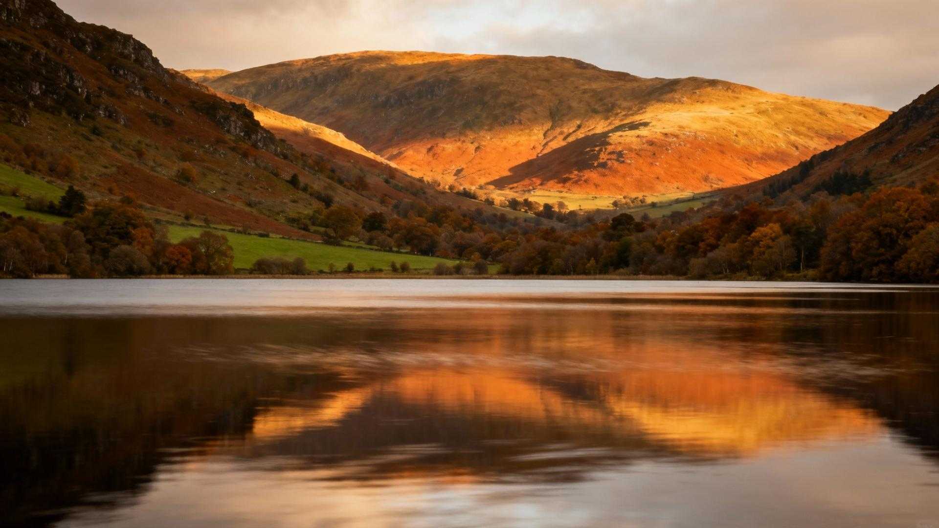
Deep in the heart of Cumbria’s fell country, Haweswater reservoir stretches through a glacial valley with the same dramatic grandeur as Scotland’s most celebrated Highland lochs. The pewter-colored waters mirror surrounding peaks in classic Scottish fashion, creating an atmosphere that would feel perfectly at home in the Trossachs.
But beneath this Scottish-inspired surface lies one of Britain’s most controversial water stories. This isn’t just another picturesque Lake District reservoir – it’s the watery grave of two entire villages, flooded in the 1930s to quench Manchester’s industrial thirst.
What makes this valley truly extraordinary emerges only during Britain’s rare droughts, when the water drops to reveal the ghostly remains of Mardale Green – a community that died for urban progress.
The Scottish illusion that masks English tragedy
A glacial valley worthy of the Highlands
Haweswater occupies a classic U-shaped glacial valley carved by ancient ice flows, identical to Scotland’s Loch Katrine that inspired Sir Walter Scott’s “Lady of the Lake.” The long, narrow profile stretches through the fells with the same proportions that make Highland lochs so dramatically beautiful – steep-sided hills rising directly from the water’s edge.
Waters that mirror Highland grandeur
Like Scotland’s finest reservoirs, Haweswater maintains that distinctive deep blue-gray clarity that shifts with weather conditions. From elevated viewing points, the surface reflects the surrounding peaks with the same pristine quality that has made Loch Katrine Glasgow’s water supply for 150 years.
The Manchester Corporation’s ruthless solution
A village condemned by parliamentary decree
In 1919, an Act of Parliament sealed Mardale’s fate when Manchester’s 751,000 residents needed water for drinking, cooking, and industrial expansion. The corporation’s engineers identified this peaceful valley as the perfect sacrifice, despite fierce local opposition that one resident recalled as futile: “no-one else protested, we were the only ones.”
The human cost of urban progress
Construction beginning in 1929 required the evacuation of every resident from Mardale Green and neighboring Measand village. The most haunting detail: 97 bodies had to be exhumed from the little church graveyard and relocated before the 85 billion-liter reservoir could fill, taking nearly a year to completely submerge two centuries of rural life.
Britain’s Atlantis emerges from drought
The dramatic reveals that capture headlines
During extreme droughts like 1976’s prolonged heatwave and 2022’s record-breaking dry spell, Haweswater drops to half capacity, exposing the submerged ruins. Dry stone walls, sections of original road, and parts of Chapel Bridge emerge as “curious gnarled shapes” that initially resemble sunbathing alligators before revealing their architectural truth.
Tree stumps that mark lost lives
The most poignant discoveries are the gate posts and field boundaries that once defined family properties and farming life. These weathered markers of vanished community appear like archaeological evidence of a civilization that thrived just 95 years ago – within living memory of local families.
Accessing the Lake District’s hidden tragedy
The Rigg viewpoint offers perfect perspective
A wooded promontory called the Rigg juts into the reservoir, providing panoramic views across the drowned valley. From this vantage point, visitors can observe the dam at the far end while imagining the two villages that once made this valley home to over 120 residents.
September conditions reveal seasonal secrets
Late summer often brings optimal drought conditions before autumn rains replenish reservoir levels. The only Welsh town where 13,000 souls run Britain’s #4 largest port offers similar themes of small communities sacrificed for larger industrial needs. Walking distances from Burnbanks parking area range 1-2 miles along well-maintained paths.
Questions about Mardale Green’s emergence
When can visitors see the village ruins?
Mardale Green’s remains become visible only during sustained drought periods when Haweswater drops below half capacity. The most dramatic exposures occurred in 1976, 1995, and 2022 during Britain’s driest summers.
What exactly emerges from the water?
Visitors can observe dry stone walls, road sections, Chapel Bridge remains, and field boundaries marked by weathered gate posts. Tree stumps also appear, marking former property lines and community spaces.
How controversial was the original flooding?
The 1919 Act of Parliament faced local opposition, but post-WWI economic conditions meant the project provided essential employment. The only castle in Britain where archaeological evidence proves Arthurian royal palace claims explores similar themes of landscape hiding dramatic historical truths.
Is the site accessible year-round?
The Haweswater shoreline path remains open throughout the year, though ruins visibility depends entirely on reservoir levels. The only town in England where 30-foot mining chimneys still guard Britain’s westernmost cliffs showcases similar preserved industrial heritage in remote locations.
This Scottish-inspired valley holds one of England’s most poignant stories – a reminder that beneath our most beautiful landscapes often lie the sacrifices made for progress. When drought reveals Mardale Green’s ghostly remains, visitors witness not just archaeological curiosity, but the physical evidence of communities that paid the ultimate price for Manchester’s industrial ambitions.
Visit Haweswater for its Highland beauty, but remember you’re floating above the dreams of 97 souls whose final rest was disturbed for urban water supplies.